Factors Affecting the Formation and Change of Urban-Spatial Organization in Ahar City of Iran
Ahad Nejad Ebrahimi1 * and Bagher Pourjavad Asl1
1
Faculty of Architecture and Urbanism,
Tabriz Islamic Art University,
Iran
DOI: http://dx.doi.org/10.12944/CWE.12.2.09
Ahar is name of a historical city located in northwest of Iran. The existing documents and historical writings along with some inscriptions, architectural and archeological monuments within the city and its suburbs all indicate the historic antiquity of this city. From the pre-Islamic period, little information is available about Ahar. Some sites such as the Jame mosque of Seljuk period and Sheik Shahab Aldin Ahary’s complex indicate that it was a developed city in the Islamic period. The aim of this investigation is the identification of the factors affecting on the urban evolution process in different historical periods. The spatial organization of Ahar has been developed within the Islamic period, but the hypothesis of research is the indications of pre-Islamic period are in the present-day location of it. The question of research is: what were the components affecting the formation and development of the spatial-urban organization of Ahar? This investigation is a basic research which utilizes the descriptive-analytic method based on the analysis of historical documents’ contents. The necessary information has been obtained through library and field studies. The research results show the following: the formation of Ahar dates back to the pre-Islamic period. Based on some historical documents and narratives, the location of the initial core of the city is considered to have been in the vicinity of the historical graveyard of the city; and since the reign of Islam, the city has developed around the core, yet at some periods of time in the course of history, the city has undergone locational changes and has developed toward the northern and western grounds.
Copy the following to cite this article:
Ebrahimi A. N, Asl B. P. Factors Affecting the Formation and Change of Urban-Spatial Organization in Ahar City of Iran. Curr World Environ 2017;12(2). DOI:http://dx.doi.org/10.12944/CWE.12.2.09
Copy the following to cite this URL:
Ebrahimi A. N, Asl B. P. Factors Affecting the Formation and Change of Urban-Spatial Organization in Ahar City of Iran. Curr World Environ 2017;12(2). Available from: http://www.cwejournal.org/?p=17100
Download article (pdf)
Citation Manager
Publish History
Select type of program for download
| Endnote EndNote format (Mac & Win) | |
| Reference Manager Ris format (Win only) | |
| Procite Ris format (Win only) | |
| Medlars Format | |
| RefWorks Format RefWorks format (Mac & Win) | |
| BibTex Format BibTex format (Mac & Win) |
Article Publishing History
| Received: | 2017-06-02 |
|---|---|
| Accepted: | 2017-03-08 |
Introduction
In Islamic written and documents Ahar has been introduced as a developed city and the location of mystics and thinkers. Its location in the connecting path of Ardebil and Tabriz has contributed to the enhancement of the city’s significance. The religious-cultural, political, commercial issues, and the short distance from Tabriz, are among other factors contributing to Ahar’s gaining significance in the course of history. The monastery of Sheikh-Shahab-Aldin-Ahari attracted the attention of Shiite Safavid kings to the city during Safavid Dynasty. Despite the importance of Ahar in the course of history, no comprehensive research has been conducted about the urban features of Ahar. The main issue of this research is to find the features of spatial-urban organization of the city.
 |
|
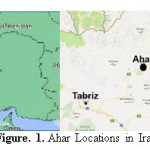
The geographical situation of Ahar is 38 degrees and 46 minutes’ north latitude and 47 degrees and 0.6 minutes’ length east, and it is located in a region named Qara-Dagh with an estimated area of 9000 kilometers and with diverse natural and climatic features. Ahar is in the central part of this flat and plain-like area which is situated in the altitude of 1341 meters higher than the sea level, among Gachi Ghiran mountains in south (altitude of 2827 meters), Qashqa-Dagh mountains in southeast (altitude of 3149 meters) and Shivar mountains in north (altitude of more than 2500 meters) (Figure 1). The Ahar-river flows in the southern part of Ahar in west-east direction. Alireza-river and Rangool-river cross it from west and Kichik-river from the middle and have several branches².
The most historical name from view point of the situation the city is placed in is related to Assyrian inscriptions. Assyrians in their inscriptions have referred to the area from the Aras-river up to the Avrin Dagh and Ghara Dagh mountains as “San Gi Bouto”, and it has been a part of a country named Urartu¹. On the other hand, since the time of Mongol Ilkhans the word Qara-Dagh itself has referred to the mountainous region in the center of which Ahar is located.
Some writers have attributed the calling of the region as Qara-Dagh to the existence of Basalt and the blackness of its mountains³. Since the year of 1315 (Iranian calendar) and during the second trip of Reza Shah Pahlavi to the region with the aim of supervision on the residence of nomads, the historic name of the region was changed… into Arasbaranâ´. According to the early 19th century’s British diplomat and the author of “Adventures of Hajji Baba of Isfahan James Morier, the city prior to Islam was called “Hara”. “From the name of Ahar it can be gathered that this city is the same “Hara”, which according to the book “Chronicles”, chapter 5, verse 26[ii], was one of the three cities to which the Jewish tribes of “Reubenites”, “Gadites” and half of “Manasseh” were exiled by Assyrian king “Tilgath Pilneser”. … The letters which are in the words also exist in Ahar, and transposing the syllables or the letters with more or less the same sound is common in the East… Its relative location which is in the vicinity of Khalkhal and Abhar also confirms the above surmise…” âµ. Also Mu’jam Albaldan has discussed the usage of the word “Ahrij” instead of Ahar: “I saw one of the rhetoricians by the name of Ya’mar, the son of Hassan, the son of Mozafar, the secretary scholar and the writer of compiled letters, who in his letters called Ahar as Ahrij, and I guess that he himself was from that city…” â¶.
Methodology
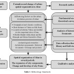
The urban evolution process distinguishes based on the architectural elements and the analysis of historical writings and documents. The aim of this investigation is to find the shaping and structural features, also extract the existing relations among the formed divisions in different historical periods. Question of the research: which components have affected the formation and development of Ahar in the historical periods? The indications of pre-Islamic period are in the present-day location of Ahar, but the spatial organization of it has been developed within the Islamic period. This investigation is of fundamental-theoretical type which utilizes the descriptive-analytic method based on the analysis of historical documents’ contents. The necessary information has been obtained through library studies and field studies (table 1).
 |
|
Archaeological researches
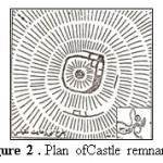
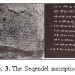
According to the researches of German archaeologists, out of the documents related to the centuries before Islam, is the remnants of a castle (Figure 2) 20 kilometers north of Ahar³. The Seqendel Inscription, (Figure 3), it's the most significant document that has remained from Urartians in Qarrah-Dagh Region in the slope of Zaghi Mountain. In this inscription the decree of Sardor II (the son of Arkishti/ 1911-1940 AD) is silvered in ten lines in cuneiform and in
 |
|
 |
|
Urartian languageâ·. The beginning of the Islamic government in Qarrah-Dagh Region is from the third decade of the formation of the Islamic government. During Omar caliphate (the second caliph) in the 642 AD, Arabs under the commander Bekr ibn Abdollah entered Qarrah-Dagh. However, attrition wars with native Warriors like Babak Khoram who used to rise in the reign of Mu’tassim continued up to the middle of the fourth century of the Hegira (10th century A.D.) ³. During the caliphate of Abu Ja’far Mansoor Abbasi (677-753 AD), Ravad, the son of Mosanay-e Ezdi went to this territory upon the invitation of Yazid Ibn-e Hatam, the governor of Azerbaijan, and governed the city of Bazz (one of Ma’moori cities in Qarrah-Dagh). After Ravad, his three sons by the names of Vajna’ (contemporary with Haroon Alrashid 786-804 AD), Mohammad and Yahya inherited the throne, respectively. Therefore, according to Ibn Khordadbeh in the 3rd century of the Hegira (9th century A.D.), for a long time the territory of Qarrah-Dagh¹, Tabriz and probably some other cities of Azerbaijan were reigned by Ravad Ezdi dynastyâ¹. After the imprisonment of Yahya, the third son of Ravad, by Hamdooyeh ibn Ali - Bagha – in 849 AD, nothing is known about Ravady dynasty till Mohammad Ibn Hoghel Baghdadi (known as Ibn Hoghel/ 978 AD) in his book Sorat-Alarz introduced Abu Alhija’ Ibn-Ravad as the governor of Ahar and Varzaghan in 955 AD. He paid 50,000 Dinars annually as tribute to Ibn Mohammad. In introducing Azerbaijan cities, Ibn-Hoghel mentions Ahar and Varzaghan along with Ma’moor cities, and writes, “… Ahar and Varzaghan are among relatively
 |
|
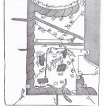
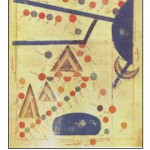
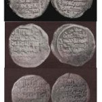
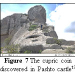
big cities of Azerbaijan. They are green cities and have gardens with mass trees and different fruits and possess blessings and boons.”¹â° (Figure 4). The anonymous book Borders of the World written in 982 AD about general geography was granted to Amir-Abu-Al-Hares-Mohammad-Ibn-Ahmad from Farighunids dynasty. In this book, it is written about the northwest of Iran that: “about the area of Azarbadgan, Arminieh, Arran and their cities can to say: three areas are joined to one another” ¹¹. In continuing with the introduction of the cities of the three areas. Ahar, Khoy, Salmas, Marand and Meymad have been introduced in the Arminieh area: “Ahar – is the village of Meymad and the kingdom of the son of Ravad, one of the children of Jalandi” ¹¹. In this book such cities as Qaban, Barda, Ganja, Teflis, Sogh Aljabal, Shirvan, Baku, and many other present-day cities in the north of the Aras-river are referred to as belonging to the Arran area. Also, in his book Routes and Countries written in the first half of the 4th century of the Hegira (10th century A.D.), “Abu Ishaq Ibrahim Estakhri” has depicted Arminieh, Aran, and Azarbijan on a map and has specified the location of Ahar in the route of Ardebil to Debil (Figure 5) along with other cities¹². In his third volume of Lexicon of Countries, “Yaqut_al-Hamawi” in 1228 AD mentions Ahar as, “A developed city which despite all smallness is full of pleasantness. In districts of Azerbaijan, between Ardebil and Tabriz, its governor is called Ibn Pishkin. A group of jurists exegetes have arisen from there.”â¶. During the governance of Ibn Pishkin in Ahar, coins were minted for him. The evidence for this claim are the four cupric coins (Figure 6), one of which was discovered in the vicinity of Pashto (Figure 7) castle located 50 kilometers northeast of Ahar, and according to the Iranian famous numismatist, Seyed Jamal Torabi Tabatabaee, all three were minted in Ahar and belong to the 7th century of the Hegira (13th century A.D.) ¹³. The following words are written on the coins: “Atabak Alazam, Abu Bakr Ibn Mohammad, Uzbak Ibn Mohammad, Malk Alomara, Bishkin Ibn Mohammad, and Zarb Baher.” â·. An important event of 7th century of the Hegira (13th century A.D.) in the reign of Ilkhanate was the murder of “Khajeh Shams Aldin Mohammad” by the order of Arghavan Khan, the son of “Aba Ghan Ilkhan”, in the vicinity of Ahar on Monday the4th of Shaaban of the year 1284 AD. Khajeh was the prime minister and in fact the most powerful man, only second to Ilkhan
 |
|
 |
|
 |
|
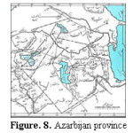
himself[i]â·. Mohammad Ibn Nasr Mostofi, the author of Nozha Algholoob in the 1339 AD, in the third chapter about the territory of Azerbaijan and Tabriz writes, “And that is nine tumens and 27 districts. The weather mostly tends to be cold and a little while is moderate. Its border is connected with the province of Ajam Iraq and Moghan and Georgia and Arman Kurdistan…” ¹â´. In this book Meshkin State, one of the nine States of Azerbaijan territory, has been mentioned. The writer mentions the distance between Ahar and Tabriz as 14 leagues¹â´; and writes about Ahar,” Ahar is a small town with cold weather. Its water springs from a river flowing from the Eshkanbar mount and from aqueducts. Its agricultural products are cereal and some fruit. The religion of its people is Shafi'i. The income of its court is about 10,000 Dinars…” ¹â´. Based on the current situation and location of Ahar, the descriptions of Nozhat ol-Gholub, written in 8th century of the Hegira (14th century A.D.), can be considered as correct and relatively complete. This book states that Ahar, a little town north of Tabriz and beside the Ahar-river, has a direct route of 90 kilometers to Tabriz, the capital of Ilkhanate government. The direct route between Ahar and Tabriz along with naming one of the Tabriz gates as Ahar are indicative of the close and continuous relationship between the two cities. In other words, analyzing the above matter we can reach the conclusion that Ahar was a developed and commercial city due to having close relations with the capital, and undoubtedly enjoyed an urbanization system and architectural elements specific to an Islamic city. “Zeynalabdin Shirvani” in his book “The Flower Bed of Journeys”[ii], written in 13th century of the Hegira (19th century A.D.), refers to Ahar as a “delightsome village from Azerbaijan territory which is said to be attractive.”¹âµ. Other historical sources have also mentioned Qarrah-Dagh and Ahar, some of which are collected in “Vasily Vladimirovich Bartold's” 1929book titled “An Historical Geography of Iran” written in the early 20th century A.d. A similar book is “The Lands of The Eastern Caliphate” by “Guy le Strange 1998. Some of the materials of some historical sources about Ahar are collected in the 11th chapter of Strange's book. He has also provided a diagram of Azerbaijan’s routes (Figure 8) which is noteworthy.
 |
|
Prior to Islam
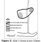
The first survey for familiarization with the position of Ahar prior to Islam was conducted by Rahim Kashefi Ahari, a history professor and a grandson of Sheikh Sultan Shahab Aldin Mahmood Ahari. Based on his writings, the formation of Ahar and its initial core can be occurred near the confluence of the Ahar-river and the Kichik-river (Figure 9). During his visits in the year of 1342 -Iranian calendar-, there exited the remnants of buildings in this area which are known as Zaleshlar and Dizelasht, and there were two cemeteries in both sides of this region, which still exist. The researcher refers to the etymology of the region’s name (Zaleshlar and Dizelasht): “Zaleshlar is the same as Zarathustras, composed of Zalesh=Zarathustra and Lar which is a plural suffix in Turkish. Dizelasht is a combination of the two words monastery and Zarathustra which has changed in compact form into the present name” ¹â¶. During the archeological operations conducted in recent years by Cultural Legacy and Tourism Organization of Azerbaijan province, an area related to the first millennium BC, known as “Kul Tapeh”, was discovered around this region. Based on these findings, the specified position in the south of the present-day Ahar can be considered as the origin of residence in this city.
 |
|
 |
|
 |
|
 |
|
From Formation of Islam’s Government to Late Safavid dynasty
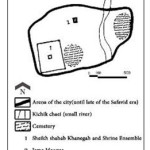
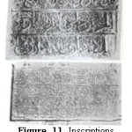
In continuation of the city’s life and with the beginning of Islamic government and the promotion of the true religion of Islam, it seems the urban development process, taking the position of the historical Jame mosque, has been toward the northwest of the initial core (Figure 10). The Jame mosque of Ahar dates back to Seljuk and Atabakan periods, and there are inscriptions in later centuries indicating the repair of the building (Figure 11), the last of which dates back to the time of “Haji Mirza Babay” in 1745 ADâ·. It can be concluded form this event that since its establishment (10th century A.D.) up to the above date (18th century A.D.), the mosque has been used as the Jame mosque of the city and has always been under the focus and maintenance.
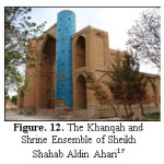
The Khanqah and Shrine Complex of Sheikh Shahab Aldin Ahari (Figure 12) were established during his lifetime (1266-1184 AD) in the west side known as Dizelasht and Zaleshlar¹â¸; the reason of its establishment in this area is probably due to its closeness to the residential part of the city.
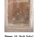
150 years before the date of the last inscription of the Jame mosque, in 1609 AD, Sheik Baha'i, the great genius of Safavid, who had traveled to Ahar with Shah Abbas (Existence a handwriting of Sheik Baha'i refer to this event in old mosque in Sheikh Shahab Aldin complex) (Figure 13), established a bathhouse in the east of the city’s Jame mosque and devoted it to the Sheikh Shahab Aldin complex¹â¹. This bathhouse was later known as “Eshih Bathhouse” (Eshik bathhouse/ external bathhouse); a part of it was destroyed during road makings of recent years, and according to elder people, a part of it is buried underground.
There are evidences which show residence in these areas was disrupted for a while due to the following reasons: The cessation of repair and maintenance of the Jame mosque since the second half of the 18th century A.D., using the word “external bathhouse” for the neighboring bathhouse of the Jame mosque, the current gossip among Ahar people to the effect that the Jame mosque had been deserted and buried for a while and was revived after many years, and the existence of a completely Qajar residential context in this area despite the presence of the Jame mosque, which has a much more antiquity. The reason of this disruption can be due to the terrible earthquake of Tabriz in 1779 AD²â° in which Ahar was also destroyed due to its close distance to Tabriz, or it can be due to another earthquake toward the end of 18th century A.D., about which, unfortunately, there exists no report.
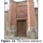
Although during this time the Jame mosque and the context around it loses its previous boom, it does not mean that residence in this place was stopped for many years. Construction in this area gradually and along with the development of the city began, so that today some valuable houses dating back from Qajar period can be seen in these neighborhoods (Figure 14). It is to be noted that the Jame mosque is placed in a much lower position compared to present-day surrounding buildings, which confirms the possibility of later construction on the ruins of the old buildings which are perhaps contemporary with the Jame mosque.
 |
|
 |
|
 |
|
Qajar Period
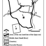
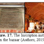
Whereas in this period the city development often took place in the north of the previous settlements, construction on the previous city continued (Figure 15). While the urban role of the Jame mosque in the damaged part lost significance, other mosques were built in the city, the most important of which, based on the stone inscription of 1860 ADâ·, was the wooden mosque of “Sheikh Emad” (Figure16). This mosque can be considered as the second important mosque and the religious pole of Ahar, which along with the bazaar as the city’s commercial pole are commonly considered as the center of Ahar. Series of roofed and unroofed bazaars made of entering gates up to the city center are the significant urban elements of this period, which according to the inscription installed in the roofed bazaar (Figure 17), “Rashid Almolk” in 1903 AD founded the dome of the central part of this large building. Undoubtedly, the construction of such a large bazaar as the roofed bazaar of Ahar cannot be attributed to the efforts of one single person in a single period. Different requirements, potentials of city and region also physical structure such as routes, barriers and city gates are influenced to formation and expansion of bazaar which are achieved during long times. However, Rashid-Al-Molk action can be regarded as a kind of business atmosphere organization in the city, which had employed all previous potentials and capabilities. On the other hand, due to the connection of unroofed bazaars to roofed bazaars from several directions, we can talk of a kind of reconstruction conducted by Rashid-Al-Molk in the present-day location of the bazaar through the destruction of a place similar to the present-day unroofed bazaars, and building a roofed bazaar.
 |
|
 |
|
In this period there also existed a fortification around Ahar, and entry to the city was possible through gates. The location of the city’s entering gates can be found through tracing the commercial and residential architecture of this period and knowing the suburban cemeteries and the historical routes into the city. The four gates form Tabriz, Kaleybar, Ardabil (entry form Meshkin shahr to Ahar was done through this route too), and Howrand routes were the entrances into the city. The city included nine neighborhoods, namely Karbalayee-Karim, Uch-Dokan, Dabbagh-Khaneh, Dieh-Masjed, Sadatloo, Nakhjavanloo, Hasel-Hayati, Sheikh-Emad, and Bazaar²¹.
James Morieh around 1810 AD writes,”… In Ahar gate, there is a conspicuous building on the hill, which can be seen from afar. Here is the tomb of Sheikh Shahab Aldin, the teacher of Sheikh Safi, who according to Iranians is the founder of Safavid dynasty. … Ahar is the capital
 |
|
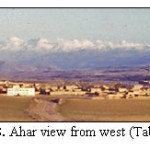
of Qara-Dagh. It has very high barriers…” âµ. As the tomb of Sheikh Shahab Aldin Ahari can be seen in the heights of the city suburb when approaching the city gate (Figure 18), his entry to Ahar can be known to be from Tabriz gate.
In 1299 -Iranian calendar- (1968 AD) the military government senior commander of Qara-Dagh in a war with the nomads of Haj Khajeloos, Shahsavans, and Haj Alilos, ordered to erect seven three-story towers around Ahar, in addition to the fortifying wall of the city, and build trenches in the southern neighborhoods. These measures had a significant contribution to the protection of the city which was surrounded for four months by attackersâ´. Also, “Hamideh Khanum Javanshir” after reaching Ahar in 1920 (1299 of Iranian calendar, toward the end of Qajar government), which undoubtedly was after the war between the senior commander and nomads of Qara-Dagh, writes about it, “Advisers… told that the city gates are closed immediately after sunset because of the turbulence… The sun was about to set when we reached the city. The castle doors were closed. Mirza Ali Akbar got off the horse and told something to the guard. The door was opened and we entered…” ²³.
Based on these remarks the existence of tower and castle up to 1299 -Iranian calendar- is confirmed. These people entered Ahar from Kaleybar route gate.
Pahlavi Period
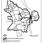
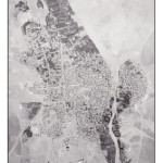
The action taken in “Persian Constitutional Revolution” [i] period 1906 -1925 for establishing a federal government caused many local fights which weakened the cities’ security. This led to the easy acceptance of Reza Khan by people in 1925. Following the fights with the regional oppositions and eliminating the opposition Khans, which undoubtedly led to the establishment of security in cities and reduction of local fights, the fortifications around the city gradually lost defending significance and the city grew out of its walls. During these changes, the most important of which in Qara-Dagh was accommodating nomads in the areas around Ahar up to 1937â´, probably the first group which began to construct outside the city’s fortifications and caused the city to develop, were affluent and middle class people who left the small houses within the castle and began building large houses outside it²¹. In this period Ahar was expended in the north, west and southeast areas through the development of Sadatloo neighborhood and formation of Dr. Ghasem Khan (the son of Haj Hassan, a formerly wealthy individual in Ahar) and “Galik Alti” neighborhoods (Figure 19). Some
 |
|
 |
|
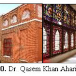
of the garden-houses built at that period exist today, out of which the houses of “Dr. Ghasem Khan” (Figure 20) and “Bashir Amer” can be cited, which were built during the early stages of Pahlavi in accordance with the common patterns of Qajar era.
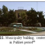
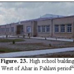
After the first decades of the beginning of Pahlavi government, the gradual changes in people’s life and livelihood caused the development of the city to gain speed through increase in population, immigration to cities from villages, and consequently establishment of new neighborhoods in waste lands around the city. Also the condition of the former city is transformed through changes resulting from establishing streets and widening roads. The east neighborhoods of the Kichik-river, north and west of the Sheikh-Shahab-Aldin complex, and Sheikh Shahab Aldin north-south street, are belong to this period (Figure 21). The architecture of this period has differences with that of the previous periods in pattern, material composition, details, and decorations. The architectural characteristic of this period, to be seen in municipality building (Figure 22), some schools (Figure 23), and residential houses of Ahar.
 |
|
 |
|
 |
|
 |
|
Conclusion
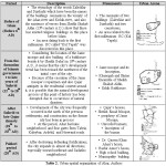
It is possible to prove the existence of Ahar in pre-Islamic period. The etymology of Ahar and several places of it confirm the existence of a city in the present position at pre Islamic period. The Urartian inscriptions in the skirt of the “Zaghi” mount and the remnants of Sassanid castles in the vicinity of Ahar, are some evidences for this case. Ahar is accurately listed beside of other cities in valid documents and maps of Islamic periods. Also in some of them it has been explained. Awareness about the situation and city condition in the Islamic period, through analysis of historical sources is possible. Ahar is referred to as a developed city in all documents of the early centuries of Islam. Short distance to Tabriz as a city which for long has been the political, religious and scientific pole of Iran especially between the 10th and 14th century A.D., and the existence of the court of Sheikh Shahab Aldin Ahari has caused the famous religious and state people to be present there and the city expanded. Despite the existence of the Jame mosque built during several hundred years up to Safavid dynasty, based on the information obtained from historical documents, the major context of the historical city of Ahar belongs to Qajar period, and the commercial elements of the city including roofed and unroofed ones are the major architectural monuments which has reached us from that period. While there also exist houses, mosques, bathhouses belonging to this period in the central context of the city, especially around the Jame mosque’s bazaar, as well as valuable garden-houses from Qajar dynasty and governmental and service providing buildings from Pahlavi dynasty, the city can be seen to develop and grow in different historical periods while keeping its significance (Table 2).
References
- Mashkur, M. J. Glance to history of Azarbaijan and Ancient Monuments and its demography. National Heritage Association, Iran, (1970)
- National Geoscience Database of Iran, Available at: http://www.ngdir.ir/Default.asp, (2016)
- Hafezzadeh, M. Arasbaran in the epic and history. Mahde-Azadii,. Iran, (1997)
- 19 Sedghi, N. Arasbaran's (Qaradagh) Social and political history in the contemporary era. Akhtar, Iran, (2009)
- 15 Morrier, J. A journey through Persia, Armenia and Asia Minor, to Constantinople, in the Years 1808 and 1809. Toos, Iran, (2006)
- Al-Hamawi, Y. Dictionary of Countries. Cultural Heritage Organization, Iran, (2001)
- Torabi Tabatabaee, J. Ancient Monuments of Azarbaijan: Monuments and historic buildings in the cities of Ardabil, Arasbaran, khalkhal, Sarab, Meshgin shahr, Mughan. National Heritage Association, Iran, (1976)
- Dosti, H. Glance to history and geography of Arasbaran: Ahar, Khoda Afarin. Ahrar, Tabriz, Iran. Ahrar, Iran, (1994)
- Ibn Khordadbeh, A. The book of roads and kingdoms. Mirase melal Institute of Historical Studies and Publications, Iran, (1992)
- Ibn hawqal, A. The face of the Earth. Dar Maktabat Al-Hayat, Lebanon, (1992)
- Hudud ul-'alam: Min al-mashriq ila al-maqrib. Sotooden, Iran, (1983)
- Estakhri, A. Traditions of Countries. Institute of translation and book publisher, Iran, (1968)
- Khamachi, B. Historical castles of Azarbaijan. Pourhoseyn, Iran, (2004)
- Mustawfi, H. Nozhat ol-Gholub. Iran, (1958)
- Shirvani, Z. The Flower Bed of Journeys. Iran, (2010)
- Kashefi, R. The prideful bibliography of Sheikh Shahabuddin Mahmoud Ahari. D. Thesis, University of the Istanbul, Turkey, (1963)
- Available at: http://beytoote.com
- Kabirsaber, M.B., Ibrahimi, M.R. The historical Recognition of Architectural evolution in Sheikh Shahab Aldin Ahari Complex. Journal of Studies on Iranian-Islamic City, (12): 71-78 (2013)
- Dosti, H. Arasbaran's memorable days. Yaran, Iran, (2008)
- Ambraseys, N., Melville, C. P. A history of Persian earth quakes. Agah, Iran, (1991)
- Marjan consulting engineers. Detailed map and Comprehensive plan of Arasbaran. (1991)
- Pitzer, P. C. Hello Mister. Blurb, USA, (2015)
- Javanshir, H. K. The memories of Mirza Jalil. Pazhohande, Iran, (2000)
- Available at: http://www.dolan.ir


